Friday, August 28, 2015

2015 Colorado Caching – Final

There was a cache at a cemetery near the inn that we thought we could get first off and have Kiowa County but we couldn’t find it.  So we headed east on Highway 96 for about nine miles and then turned north on a gravel road.  We found one out in the sage aptly named “Sage and Yucca” that hadn’t been logged in six months.  We turned around and went back crossing Highway 96 and continuing south on County Road 49 where we found one at a place where a multitude of very old cars had been seemingly dumped in a ditch.  County Road 49 turned into County Road 8 when we left Kiowa County and were back in Prowers County.  At Lamar it changed to US 287 where we traveled south all the way to just past Springfield then turning west on Highway 160.  As it turned out we made a big mistake in not getting gas in Springfield but there were a couple of towns ahead well within our range so we didn’t stop.  

We stopped at a fairly good sized cemetery outside of Pritchett for our Baca County cache.  Pritchett would be a good place to gas up but there was no station there.  The next town was Kim which would be our last chance.  I have an app called “Gas Buddy” that gives the price and location of the nearest gas stations and I was relieved to see that there was one in Kim.  We picked up another cache a short ways down the road also in Baca County.

Just a few miles before reaching Kim we crossed the line into Las Animas County and found a cache at the Highway 109 intersection.  We also noticed a sign that said Highway 160 that we had planned on taking all the way to Trinidad was closed.  If we hadn’t picked up that cache at the intersection we would have been out of luck for Las Animas County.  However, as we did have the cache we saw we could now take Hwy 109 up to La Junta and actually shorten our journey a bit. 

Lee Ray - the good Samaritan
But first things first.  We did not have enough gas to make it to any town except Kim.  We zipped into the tiny town of Kim and did indeed find one single gas pump.  However, it was closed on the weekend.  Guess what day it was?  That’s right – Saturday.  There appeared to be only two or three businesses in town and the only one open was a kind of tire shop/garage.  We met the owner, Lee Ray Jackson, who had just depleted his spare gas.  Without even asking he immediately offered to siphon gas from one of his vehicles, which he did.  What a guy!

With gas to go we headed back to the intersection and turned north toward La Junta.  As this was an unplanned route we had no caches lined up.  Nevertheless, it was a good motorcycling road with little traffic.  At La Junta we were back on the route we had traveled the day before for about ten or twelve miles.  When we got to Rocky Ford we picked up another cache for Otero County called “Yippee ki yay!”.  It was a micro on the support of a big metal cowboy attached to the side of a building.  I  was looking up telling Yancey I didn’t see anything and it was because he had it in his hand.

We were back on an unplanned route heading northwest on Highway 50 which follows the Arkansas River.  As mentioned, this new route was going to shorten our journey a bit.  The only problem was that it was going to bypass all but one of the caches I had lined up for El Paso County.  We hit Interstate 25 just north of Pueblo about where that one cache was supposed to be – only it wasn’t there.  iPhones to the rescue.  We both have a Geocaching app on our phones and we located a cache just across the Interstate less than a quarter mile away.

Mission accomplished (except for logging the final).  Unfortunately, we got into terrible traffic as far south of Denver as Colorado Springs.  Finally Yancey had had it and got on a toll road.  It added about ten miles to our journey but was much faster.  We got into Yancey’s well before supper and now all I had left was to find and log the final cache in order to get credit for the “64 County Challenge” cache.  It was located about 40 miles west and I decided I would try it the next morning and take Kathy and the dogs with me in the truck.

Climbing to the Final
There she is
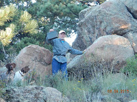
Kathy and I got an early start the next morning and the traffic wasn’t too bad.  Most of these state county final caches are pretty straight forward and easy.  Arizona was an exception and so was this one.  We eventually ended up at a golf course at Evergreen.  The coordinates put the cache on the other side of the golf course.  It was too early for golfers and there were some rough dirt roads winding through the course.  We took one of these and winded our way to the other side.  I climbed up a fairly steep hill and eventually found the cache amongst some big boulders.
Victory at last
Kathy heading down from Final
Just before we got back down I heard a horn honking down at my truck.  Soon I was there to find a very irate grounds keeper telling me I was trespassing on private property and that my truck could not be taken out till that night.  I told him that wasn’t going to happen and he eventually calmed down enough to allow me to leave.  He had never heard of Geocaching and knew nothing about the cache up the hill.  There may have been trails to access it from the other side of the mountain but we had no knowledge of that.  Naturally Kathy was super upset and I wasn’t exactly sitting on cloud 9 myself.  In our defense, there were no signs or anything to tell us we couldn’t drive on those roads.  The incident did manage to ruin what should have been a very triumphant moment.


Yancey’s Uncle Bob Sharp was arriving at noon so we stayed to see him before leaving a little after lunch.  We drove to Rock Springs arriving in the late afternoon.  We had dinner at Dickie’s BBQ, one of my favorite places to eat.  Our motel was very old and kind of a dump.  There was a good place to exercise the dogs nearby so it wasn’t all bad.  We had breakfast at a Subway the next morning and drove all the way home which was about 760 miles.  It was a long day but not too bad, probably because we stopped a few times to walk around.  The motorcycle part of the trip covered 2,200 miles with a couple of days over 400.  They were all long days (over 12 hours) because of stopping to get the required caches.  Another state crossed off the list and a lot of good memories doing it.  M/W


1 comment:

Hallie said...

Well, I guess you're all done with geocaching now that you have them all. ;P