There were only three geocaches I hadn’t found in the Grangeville area (except for one at Tolo Lake that continues to elude me). All of these are down on the South Fork of the Clearwater River. I’ve been eagerly anticipating going after these. It’s fairly rare that something you’re enthusiastically looking forward to turns out to meet expectations but this did.
Today (Aug 11th) was forecast to be very hot. In fact, one of my riding buddies declined my invitation to accompany me because of the heat. Nevertheless, I left the farm this morning on my little XT250 a little before 8:00. It was very pleasant as I rode into Nezperce and proceeded down Hwy 64 toward Kamiah. The first 8 or so miles of Hwy 64 takes you across the rolling hills of the Camas Prairie before it drops off to a grade descending to Kamiah. At the start of the descent you hit 3.2 miles of gravel with a big drop off on your right. As you approach the bottom the pavement resumes but narrow, winding and no lines. Most of this part of the road is shaded and very pleasant.
At
Kamiah I proceeded east on Hwy 12 to Hwy 13 at Kooskia where I
stopped for gas. My XT mileage on that tank was 83.3 mpg. I
continued down the river on
Hwy 13 until it turns up the Harpster
Grade to Grangeville. At that point the road that follows the river
is Hwy 14 going to Elk City and beyond. Just beyond the intersection
of the Mt. Idaho Grade there is a rest stop called Blackerby. It’s
named after a famous and much respected Supervisor of the Nez Perce
National Forest responsible for building many of the hiking trails in
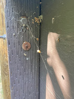
the area. The cache there was well disguised in a DNA container
behind a rusty washer embedded in one of the sign posts.
 | |
| Blackerby |
The next cache requires you to cross the river on Hungry Ridge Road which is a gravel forest road. The cache is called “The Mill Creek Blowout Disaster” named for a flash flood in 2008 that came down the mountain and wiped out the road. You can make out where in came down.
 |
| Footbridge to Switchback |
The last cache was called “Switchback” and was my favorite. I must need to upgrade the map on my GPS because it showed a road crossing the river before I got to the footbridge which actually led up to the cache site. At the bottom of the footbridge I met a couple of hikers from SD. I began hiking up the trail with them for a while but they soon stopped wanting me to go on by. They looked to be in their late 50’s or early 60’s and the man had recently had heart surgery and the woman had had both knees replaced. Got to admire them because the trail was steep. The cache was about a half mile up climbing 400 feet in that distance. It was on a ridge with a nice view.
 | |
| Mill Creek Flood |
By the time I got back down it was mid day and hot. I turned back and rode up the Mt Idaho Grade to Grangeville where I stopped in the shady park and ate my lunch. It was cooler there and pleasant. I rode back on Old Hwy 7 to Nezperce covering some of the same road I had the day before on my bicycle. The Lawyer’s Canyon draw is MUCH easier traversing on a motorcycle. I got back to the farm around 1:30 having covered 182 miles on a great little adventure with no damage to me or the equipment – not always the case. M/W
No comments:
Post a Comment